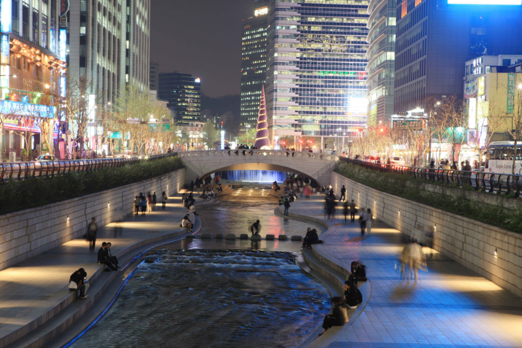
The stream that has evolved through the Japanese colonial period, the Korean War, and the transformation from a developing country to a developed country mirrors the changing history of Seoul. It is a site of a river restoration project that has received positive evaluations from abroad.
Access by subway
Based on Cheonggye Plaza, Gwanghwamun Station on Subway Line 5
Information
This stream reflects Seoul’s transformation from the Joseon Dynasty, through the Japanese colonial era, the Korean War, and into its development into a modern city.
The southern part of Seoul during the Joseon Dynasty, when Seoul first became the capital of a country, was Namsan Mountain, and Cheonggyecheon Stream was a natural river that passed through the middle of the capital at the time. Starting near Inwangsan Mountain and joining the Jungnangcheon Stream after passing through Jongno, this 10 km-long stream was often dry in spring and fall but frequently flooded in summer, causing significant damage to the people. This led to ongoing flood control projects from the time of King Taejong of Joseon and continued into the Japanese colonial period. Due to frequent flood control efforts, the stream was originally referred to as Gaicheon (a small stream) but was renamed Cheonggyecheon during the Japanese colonial period. It was also considered a boundary dividing the Korean residential area in Bukchon from the Japanese residential area in Namchon. The Japanese planned various improvements, including covering Cheonggyecheon, and moved public offices south of the stream to the upper side, but most of these plans were halted and not completed.
After the Korean War, many refugees who flocked to Seoul for survival settled along Cheonggyecheon, leading to the creation of shanty towns. The stream became heavily polluted due to domestic wastewater, turning it into a slum area. As it became a symbol of filth and poverty covered in trash and sewage, solutions were sought, and the government chose the simplest method, which was to cover the stream.
Starting in 1958 and continuing until 1977, the stream was covered from Jongno to Majang-dong (near Yongdu Park, Yongdu Station on Line 2). Modern commercial buildings, covered roads, and elevated roads were constructed over it, transforming the area into a hub of urban industry. In the 1960s and 70s, this area symbolized successful industrialization and modernization, with various shops and markets lining both sides of the roads.
In the 1980s and 90s, while it remained a center for industries such as tools, printing, and clothing, it also became associated with the negative aspects of industrialization, including noise, congestion, and pollution. The deterioration of the covering structures and the Cheonggye Elevated Road raised safety concerns, which led to the initiation of the Cheonggyecheon restoration and the surrounding area’s renovation.
From the summer of 2003, restoration work lasted a little over two years, removing thick cement layers and returning the stream to an artificial river with some ecological restoration.
Post-restoration Cheonggyecheon
The upper reaches of the stream, running weakly from north to south, are hard to trace due to having been covered or filled in since the Japanese colonial period. Therefore, Seoul City restored only the middle and lower reaches, about 8 km from west to east, starting from the point where Cheonggyecheon Falls is installed. The restored Cheonggyecheon also serves as a boundary between Jongno-gu and Jung-gu.
To maintain Cheonggyecheon as an ecological stream with flowing water year-round, the city supplies 40,000 tons of clean water daily and manages the water depth to an average of 40 cm. The flow of water in the stream reduces temperatures by up to 10–13% and increases the average wind speed by 2.2–7.1%, contributing to the mitigation of the urban heat island effect.
The Cheonggyecheon restoration is not yet complete. Artifacts discovered during the restoration are temporarily stored elsewhere, and the city plans to relocate them to their original places and improve water quality in the middle and lower reaches as part of a long-term plan to fully restore Cheonggyecheon with its history and tradition by 2050.
Useful tips for tourists
Since this is the site of a river restoration project that has been generally well-received overseas, it would be a good idea to read in advance about the urban sociological problems around Cheonggyecheon before the restoration (the old city center of turning into a slum, etc.), the practical benefits of the restoration (rest areas in the city center, flood prevention, etc.), and areas for improvement (restoration of cultural assets, etc.).
Cheonggyecheon-ro, an 800-meter stretch from Cheonggye Plaza to Samilgyo, operates as a pedestrian-only street from 2 PM on Saturdays to 10 PM on Sundays, allowing for a more pleasant walk without vehicle traffic.
Seoul residents often fill up on delicious food at Gwangjang Market and take a stroll along Cheonggyecheon. The 5 km-long walking path from Cheonggye Plaza offers various sights along the way, providing a feeling of strolling through a quiet countryside in the heart of Seoul.
Home page
Places around
- Cheonggyecheon-ro
- Gwangjang Market
- Euljiro Nogari Street: A cool beer with good people!
- Cheonggyecheon Museum
- Myeongdong
